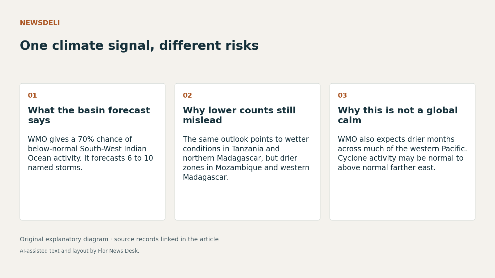
On 5 November 2026, the World Meteorological Organization said the South-West Indian Ocean is more likely than not to have a below-normal cyclone season, with a 70% probability of lower-than-usual activity and a forecast of 6 to 10 named storms, including 3 to 5 tropical cyclones. That total already includes Tropical Storm Agueda from October, and WMO says an average season has 10 named storms and 5 tropical cyclones (WMO regional update).
The easy mistake is to read that as a broad reduction in danger. The same 5 November outlook argues for a narrower conclusion: fewer cyclones are expected across the basin, but the human consequences still depend on where rain falls, where dry conditions deepen, and whether even one storm hits a vulnerable coast (WMO regional update). WMO explicitly says a low-activity season can still contain a catastrophic cyclone, and that one storm can heavily shape island rainfall totals.
WMO links the quieter cyclone outlook to larger ocean patterns that are still forecasts, not measured outcomes. Its 8 October Global Seasonal Climate Update said multi-model forecasts pointed to further El Niño intensification in October-November-December 2026, with the Niño 3.4 seasonal average near +3.7°C and warming expected to peak around December 2026 (Global Seasonal Climate Update). A separate WMO news release on 8 October said that projected level would exceed the previous November 2015 to January 2016 record of +2.6°C, while a 26 October WMO summary said sea-surface temperatures might reach 3.8°C above average in November 2026 to January 2027 and described the event as potentially unprecedented in strength (8 October WMO update, 26 October WMO summary).
That wider context matters because El Niño does not create one simple hazard map. In the South-West Indian Ocean outlook, WMO says above-normal rainfall is likely from November 2026 to January 2027 in the United Republic of Tanzania, northern Madagascar, Comoros and parts of Seychelles, while southern and central Mozambique and parts of western Madagascar are expected to be below normal (WMO regional update). In other words, the same season can point one set of places toward flood management and another toward water stress.
WMO’s broader regional summaries reinforce that split rather than simplify it. On 26 October, WMO said wetter-than-normal conditions were more likely in parts of East Africa during the October-December rainy season, while Southern Africa faced increased risk of drier conditions from November (26 October WMO summary). On 5 November, WMO’s Pacific update said much of the north-west and south-west Pacific was expected to be drier from November 2026 to January 2027, even as areas along the equator from Nauru to eastern Kiribati were expected to be wetter than usual (WMO Pacific outlook).
The Pacific record also shows why a calmer season in one basin should not be mistaken for a general cyclone slowdown. WMO says normal to above-normal tropical cyclone activity is expected in the south-west Pacific from November 2026 to April 2027, with more activity near and east of the International Date Line and normal or below-normal activity farther west (WMO Pacific outlook). The same update reports earlier water shortages linked to low rainfall between May and October in Papua New Guinea, Solomon Islands, Vanuatu, Fiji and Tonga, plus forecasts of above-normal air temperatures and marine heatwave risk around Kiribati.
The practical reading, then, is not that risk is falling, but that risk is being redistributed. That is analysis based on WMO’s own premises: a basin-wide cyclone count is probabilistic, country-level rainfall signals point in opposite directions, and different ocean regions may see different storm responses. As of 6 November 2026, WMO’s references to an El Niño peak in November or December 2026 and persistence into early 2027 remain expectations rather than confirmed outcomes (WMO regional update, Global Seasonal Climate Update). That leaves one clear conclusion: fewer expected cyclones in the South-West Indian Ocean do not, by themselves, answer where the biggest weather risks will be.